Out of wonders in this technological world, GPS on iPhone probably ranks in the first 3 places as it helps billions of people daily find cities, streets, and even small shops. However, sometimes due to an ended data package or signal loss, the maps stop working but this situation can easily be solved by downloading offline maps. So, keep reading if you want to know more!
Overview of GPS on iOS devices
GPS stands for Global Positioning System and is a satellite-based navigation system that provides location and time information anywhere on Earth.
What it involves are:
- A network of satellites orbiting the earth.
- Ground stations to monitor them.
- Receivers (like those in smartphones) that interpret the signals.
A phone’s GPS receiver calculates its position by obtaining signals from four or more satellites. Each satellite sends details regarding its location and the time the signal was sent. The receiver determines the distance to each satellite by calculating how long it takes for each signal to arrive. With these distances, the receiver uses trilateration to determine its specific location.
Phone devices’ GPS works because they directly receive satellite signals, which carry all relevant positioning data without having to connect with the Internet or mobile networks.
A phone’s GPS Receiver uses such signals to find coordinates (latitude and longitude). Many phones also have offline maps that can be downloaded beforehand so that You can know where they are located even if they do not have access to the Internet when moving around. Furthermore, built-in sensors like accelerometers and gyroscopes improve location accuracy by giving additional motion data.
How do I turn my iPhone GPS on?
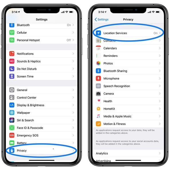
First of all, on your iPhone, locate your “Settings” app, then tap on it.
In the “Settings” folder, scroll down to find “Privacy & Security” > and click on it.
Then tap at the top of your screen where you see “Location Services.


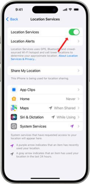
If location services are off, the toggle switch would be there > swipe this switch to the right side just to switch on Location Services, that’s all! Your phone GPS is on!


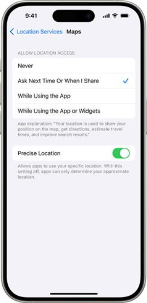
Below the main Locations services toggle, you will see a list of applications where you can individually customize each app’s location settings by tapping on them and selecting “Never,” “Ask Next Time,” “While Using the App,” or “Always.”


To switch off your iPhone’s GPS (location services) follow these same steps.
How to use GPS on iPhone without service
Let’s say you are going on a family or business trip, and somehow your internet package ended, or the network service is so poor that it doesn’t load the maps data; in that case, it will take you hours to reach the right destination. Fortunately, the GPS doesn’t rely on network service or the internet, as it directly connects to the satellites orbiting the Globe, so yes, you can use it even without a SIM.
However, the area data on apps like Google Maps or Apple Maps have to be fetched from the internet, which you can also download in advance, so even if the SIM network is off, you still get an accurate location. Pre-downloading map data also helps save data packages and enhance battery life.
Step-by-step guide to enable offline maps
1. On your iPhone, open Google Maps or Apple Maps.
2. When the app is opened > click on your profile icon ( On Google Maps, it should be top right corner, and on Apple Maps, it should be in the bottom right corner ).
3. Now, you will see the option of “Offline Maps”; simply click on it and download your required areas. That’s it. You can use Google or Apple Maps without any network service or Wi-Fi availability.
Apps that support offline GPS navigation
Almost all the built-in and third-party GPS navigation maps can support offline operations because the GPS chip, which is the main component, works without the internet.
Top offline GPS Apps for iPhone
Google Maps
Google Maps provides turn-by-turn driving, walking, cycling, and public transport directions with real-time traffic updates to avoid congestion.


You can download the Maps for offline use, guaranteeing reliable navigation in the absence of an internet connection. Furthermore, street View displays 360-degree immersive pictures of places and detailed information on local businesses ( such as opening hours, reviews, and photos ), making the user experience better. The main point here is that you can obtain public transit schedules, routes, and arrival times at your fingertips as well as searchable points of interest like landmarks or restaurants.
All Google Maps services are free and up-to-date. However, when downloading a map, it only allows a rectangular specific area to be downloaded, and you have to select multiple areas individually, which is tiresome.
Maps. me
Maps. me (sometimes called Maps with me), gives You access to a detailed map that they can download onto their devices free of charge so that even when they don’t have internet connectivity, they still have some form of direction.
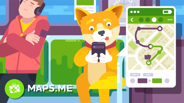


It was launched four years ago and has 4.7 rating on Google Maps. You will enjoy turn by – turn navigation with clear simple directions either driving , walking or cycling. The app has different places of interest, such as restaurants, hotels, and landmarks which help in planning travel. Additionally, there are also hiking trails featured by maps.me along with offline search functions for outdoors activities.
You may mark locations for future reference, create personalized routes, and receive travel guides. Even routing and map updates in areas without connectivity continue working offline in this application enabling seamless and efficient coverage.
Sygic GPS Navigation
Sygic GPS uses high-quality TomTom maps that can be downloaded offline, making it possible to get directions even when there’s no way to connect online.
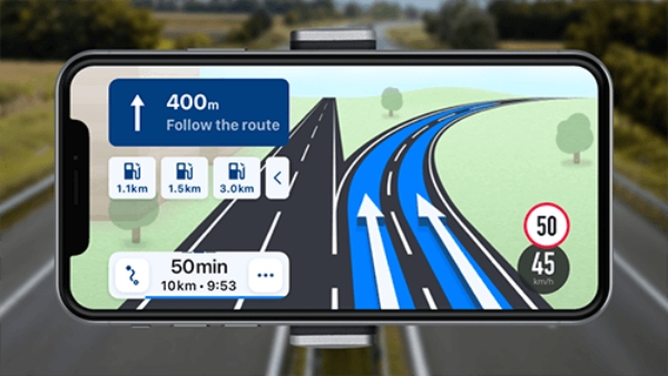


The app has voice guidance features, lane indicators, and real-time traffic updates to avoid congestion, among other things. It also offers notifications regarding speed limits, speed cameras, fuel prices, etc., thus saving users from fines and robbery cases due to ignorance.
There are two really cool things about this app: the first thing is its 3D maps that show everything as if you see it from the street but as a third person. And the second great option is its Head-up display which throws a shadow on the front windscreen and creates a hologram (only works at night). Finally, Sygic offers route planning, including alternative routes and estimated travel times.
HERE WeGo
HERE WeGo combines versatile offline navigation features in one app. You can download detailed maps for more than 100 countries to enable dependable navigation without the Internet.
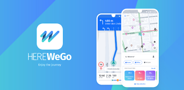


Public transport schedules are also available on HERE WeGo assisting users with bus, train, or subway directions. The app gives driving, walking and public transit directions through voice guidance. It incorporates real-time traffic information and route planners to avoid jams.
It automatically remembers where you parked your car which is nice. However, this application has some limitations: it is only available in 52 countries. It doesn’t have any advanced features such as speed camera detection or 3D maps etc.
OfflineMaps
OfflineMaps provides multiple functions for reliable navigation without an internet connection. It can be used to download and preserve detailed maps. Which can be used in those areas with poor or no network coverage.
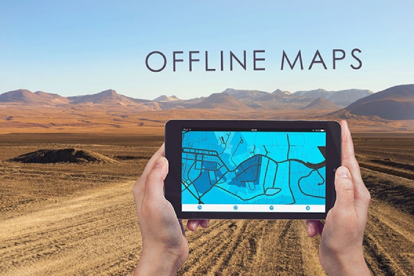


This application offers an offline search function and turn-by-turn directions for driving, walking, and biking. Additionally, it contains route planning, bookmarks, and the possibility to view and manage several maps. OfflineMaps’ navigation concept is further enhanced by offering customizable map layers and data. It enables users to personalize their navigation experience. In conclusion, it is perfect for traveling in remote areas. Because it ensures access to accurate and detailed maps whenever required.
Scout GPS Navigation
Scout Maps & Safer Navigation have more than 5M+ downloads on Playstore alone.
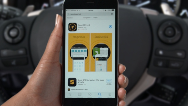


Also, this app was developed by TeleNav but looks much like Google Maps. With voice prompts, real-time traffic speed limits, school zones, and other key features necessary for smart driving, this app pretty much looks like Google Maps, though it was introduced by TeleNav.
However, some of its shortcomings are the lack of a three-dimensional mapping system for direction-finding purposes, the lesser upgrading of public places with international standards, and the unavailability in some countries.
OsmAnd Maps
OsmAnd Maps are based on OpenStreetMap (OSM ) data, which is a free, editable map of the world.



And OsmAnd maps enable downloading maps for offline use while traveling in an area with limited or no internet connection. There are both free and paid versions, though only a few maps can be downloaded in case of latter.
This application has voice guidance and visual direction solutions meant specifically while driving vehicles moving down streets as well as cycling instructions plus walking tips too. Additionally, all records may be saved in various formats such as GPX files. Lastly, OsmAnd regularly updates its maps so that users can always download the latest map data.
CityMaps2Go
CityMaps2Go is basically made for people with little to no internet connectivity.


With this tool, you can pre-download maps, including their POIs, such as restaurants, malls, and petrol pumps. You can also search for a place when you are offline. Furthermore, it has real-time traffic updates, bookmarks syncing, and multiple modes ( cycling, car, etc ); it’s all free. However, there is also a paid one that guides more thoroughly.
CoPilot GPS
CoPilot GPS offers high-quality offline maps that can be downloaded and used without an internet connection.
Multiple stop routes can be planned by optimizing the order of stops for the most efficient route. This app also offers various routing options, such as the fastest, shortest, most economical, etc.
By using CoPilot GPS, you can personalize your own maps showing or hiding particular map elements like road types and POIs, among other features that support various map styles as well as themes. You will also receive speed limit warnings as well as alerts when approaching sharp bends or any other possible dangers.
It also enables users to estimate trip costs based on factors such as fuel consumption and toll fees. It displays 3D map views to help users better understand terrain and surroundings.
Galileo Offline Maps
They also use OpenStreetMap data, and their maps can be downloaded for offline use.
This app has the same basic features as others, i.e., multiple-stop route planning, real-time traffic, etc. that include walking, cycling, and driving transportation. However, it is unique because it provides in-built compasses and rulers, which can be used for better orientation and distance measurements.
Check your kid’s last location with FlashGet Kids
Offline maps are very helpful in getting a person out of any emergency lost situation, like in a jungle, mountain area, or a wrong turn. They allow you to pinpoint your location in real-time and help you move in the right direction with live tracking ( blue dot on the map ) without even any internet or network service. So, every kid and adult must download offline maps.
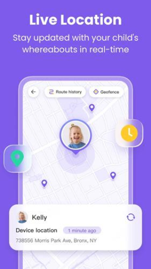
However, what about if a parent wants to track and find their kids from their phones? Fortunately, there are parental control apps like FlashGet Kids, which can do all that, such as:
- Live-location & Geofencing:
When kids go to school to study, park to play, or go to friends’ houses and aren’t picking up the phone, it’s a hell for parents. However, with FlashGet kids‘ Live location, you can see your kid going on the route, and if you set a Geofence, you will get an update whenever your kid enters or leaves a place ( enter/leave = school, park, friend’s home, etc. ).


- Location History:
FlashGet Kids also keeps a record of your kids’ traveling data using which parents can see where their kids have stopped on the way and their last known location. This is very helpful to save kids from strangers or when their phone is dead.
Conclusion
In the era of exploration, millions of people lost their lives due to incorrect routes or unknown places on Earth. But now, every person can have the whole world in their pocket for free. Offline maps are a must-have accessory for every person, young or old. As they help find the right places or escape bad ones, even without the internet.
This list includes about 10 famous apps, but you can also choose others ( but only after testing them ). Besides that, parental control apps like FlashGet Kids can help parents keep their kids secure from bunking in school. And monitor them by sending their location to parents’ phones.

